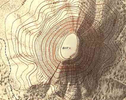
This map is an example of a topographic map that shows the relief by using contour lines. This map gives us the vertical distance in numbers. However, if those were not given the way to determine a rise in elevation is the distance the lines are from each other. The closer they get means a more dramatic rise in elevation. This map's lines get close very quickly characterizing a steep land surface.
No comments:
Post a Comment