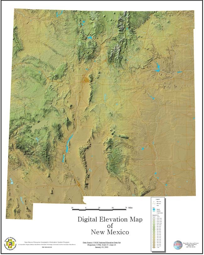
A digital elevation model (DEM) is one that shows the topography of land using remote sensing or land surveying. The model above is a DEM of New Mexico. There key is a key below the map that tells you the elevation of certain areas depending on their color. However, with the DEM it is easy to see the different elevations without a key.
No comments:
Post a Comment